Category Archives: 2023 entries
Miscellaneous, incl. Rashmi’s wedding
We recently went to Rashmi’s wedding. Rashmi is Andrew’s oldest friend apart from Nick. She joined Andrew at St Paul’s Grammar school at about age 16/15 respectively and they have gone through the IB exams together, medical entrance exams, medical school and being interns and residents together. Their academic rivalry was probably why both achieved 45s in the IB (the top mark) and both were well into the top percentile of the application to UNSW Medicine.
An old joke has been that whoever married Rashmi got Andrew as part of the contract …
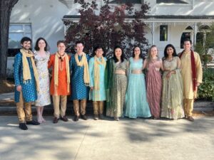
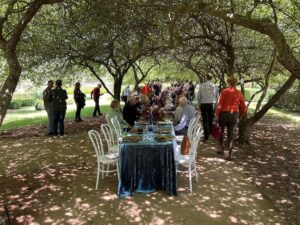
This was (another) spectacular Indian Wedding, and most of the guests wore suitable clothing. Here is a picture of Andrew and his friends at the wedding. What a truly. multicultural event! Backgrounds are Indian, Chinese, European, Phillipines, but all are Australian.
I’ve started to build another railway engine. This time in Gauge 3 (the same size as my Dyak live steam locomotive) and so twice the size of my previous builds in Scale Seven. This will be very different – battery powered and radio-controlled. Gauge three is the scale of the wagons which I have built (see the Baddesley wagons blog and other previous entries) and this is for a long-awaited garden railway in Glenbrook.
I’m having to learn new skills, including silver soldering. The frames are steel and the silver solder is much stronger than “soft solder”. THe operator usually has to use a (small) blowtorch as the source of heat
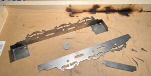 So Far, So Good. There’s a 20c coin (about the size on an old penny) to give an idea of size – this 0-6-0 tank engine will be over 40cm long. The scorch marks on the wood are because the advice is to use a “jig” of wood constructed to be at exact right angles to clamp the frames and footplate to before blow-torching them up to temperature.
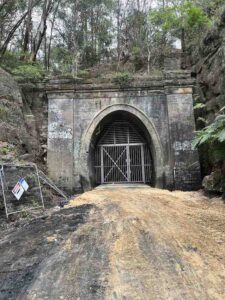
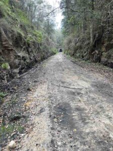
I’ve also been exploring the eastern end of the old Glenbrook Tunnel again as the local council prepare it for use as a cycleway! They have done a lot of clearing up, as you can see here.
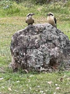 Finally, this is a view of a pair of kookaburras in Euroka Clearing when we walked down there recently.
The are wonderful birds.
Piano Fest Out West
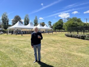
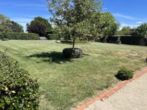 Last weekend we went out to the “Piano Fest Out West” at a station outside Bathurst. It is a weekend of beautiful piano music held at an old farm outside Bathurst, now largely used for recreational purposes, I think, rather than farming. It was owned at one stage by the Australian artist Olsen and his wife, an clearly is set up now for weekends such as this one.
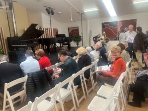 The people who run the Sydney International Piano Competition also run this event. They co-ordinated four piano-players to make the program work, at least one of whom is a past winner of their competition.
They also make it attractive by offering gourmet food and wine as part of the package.
Obviously attractive to us.
The property could easily be in the Home Counties of England, though with considerably better weather!
Not even slightly local walks (6) – Wilpena Pound and the Arkaba Station
We returned about a week ago from South Australia, where we did the Arkaba Walk. It is called one of the “Great Walks of Australia”, although how these walks are chosen I do not know. It was a very good three-day / two night luxury camping walk (see later for the “camping” accommodation !
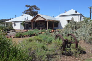 Arkaba is about 500km north of Adelaide, and so it is a bit of an effort to get there – flight to Adelaide, long drive in the hired 4WD to get to the Arkaba Station. The Station is an ex-sheep station, now being carefully reverted back to its natural state. The old station building has been beautifully converted, with relics of its past scattered around.
The guided walks are a way of supporting the efforts to do this. Arkaba Station is at one edge of the Wilpena Pound, which is an ancient volcano crater.
Our first day walking started a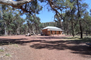 t Wilpena, and we walked right across the ancient crater to a pass over the mountain range which makes one edge of the pound, and is called Bridle Gap. On the way was a settlers cottage: it was a hard life …
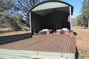
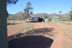
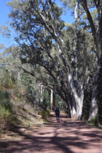 The track was very clearly delineated and easy to follow, but our guides were also useful in pointing out all the points of interest. Reaching the “campsite” (at Black Gap”) was a revelation: the sites are in fact accessible by four-wheel drive, and comprise the cooking hut, two-person open-air sleeping platforms, “long-drop” toilets (sitting in privacy, toilet paper rolls, handbasins, towels, but no flushing), and showers (via buckets of hot water, solar heated or gas). Food was excellent, breakfast good.
The second day was spent walking the length of the Arkaba Station, ending up at Arkaba Creek. Once again, the accommodation was superb, food excellent, etc. The scenery was breath-taking and the walking excellent.
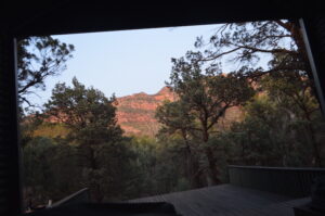
This was the scene we woke up to. Not bad, for “camping”.
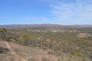 The third day was through parts of the Arkaba Station, ending up at the homestead.
An excellent guided walk. Wonderful country.
Amsterdam and the Rijkmuseum
Amsterdam is a great city. The Netherlands was clearly a very wealthy country at one time and unlike many previously wealthy states they have preserved their magnificent infrastructure well.
The museums and art galleries are wonderful. Amsterdam is a modern city, yet has kept many of its old buildings well. The canals, of course, are a major attraction also.
The Rijkmuseum is a major attraction. Not for its Renaissance art or the voluptuous nudes or the religious artwork, although there is much of that.
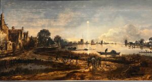
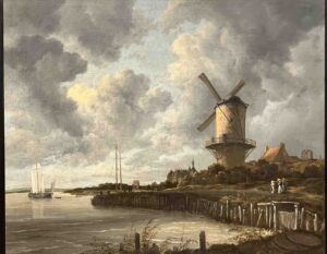
For me it is the wonderful landscapes, like a couple chosen almost at random here: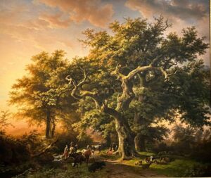
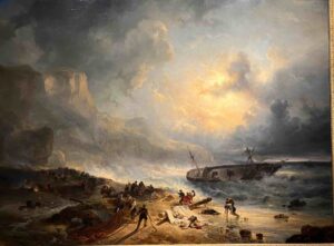
There were also some surprises:
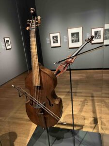
Here are a pair of musical instruments: count the strings on the bass viol – there are 6!
Look at the size of the violin!
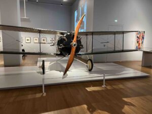
Now look at this aeroplane from the early 20th Century: What’s the most unusual thing you notice about it?
It has a motor with seven-cylinders !!!
The rijksmuseum is full of such surprises, as well as full of wonderful artwork.
The Kimberleys Day 16
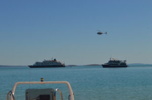 We have finished the tour really, just the helicopter flight from Naturalist Island to the Mitchell Platreau airstrip, then a 2-hour flight back to Broome.
This is a picture of our ship, with one which carries over a hundred passengers behind it.
Our crew were staying on with the replacement group of guests looking much more frail and much less mobile than our group was.
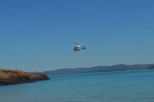
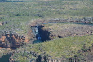
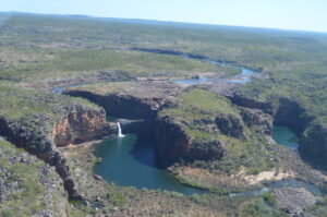
The helicopter ride was my first for over twenty years, and was very exciting. Several helicopters were using the beach at Naturalist Island for sight-seeing tours (for the larger ship), and to transfer the 19 passengers from our tour the half-hour flight to the airstrip, including scenic loops over the Mitchell Falls
On the Michell Plateau the waterfalls are spectacular seen from the ground, but less so from the air, despite their being the greatest drop over multiple levels in Western Australia.
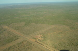 Best seen from the ground, I think.
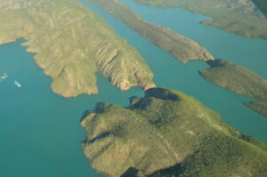
The aeroplane journey from the airstrip was in a small-but-12-seater ‘plane., over the Kimberley coastline up which we had just travelled, including a figure-of-eight loop over the Horizontal Falls (Kimberley Day 8).
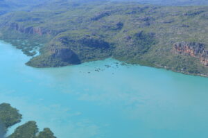 It was interesting to try to identify points of interest seen previously at ground level (water level?). Above in the centre is an area of mangrove previously seen as a dry mud area, as we stayed overnight anchored to the channel on the left (Kimberley Day 11).
This scenery was easy, though:
Here are the Horizonal Falls. The top section of water is widely open to the sea (left section in the upper photo., with watercraft visible).
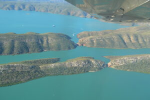 The central section, although seawater, is only connected to the sea by a narrow passage. As the tide rises, and gradient is created down into the middle patch of water, and down an even tighter passageway to the lowest lake/bay. In the lower picture it’s possible to make out a boat heading towards the gap between the hills (even though you cannot see the gap itself). Boats pass through the outer gap (as you saw us do on Day 8). Eventually the levels equilibrate, then the flows reverse as the tide falls.
These days, no-one goes through the inner rapid-flow section, since a bad accident a couple of years ago.
The Kimberleys Day 15
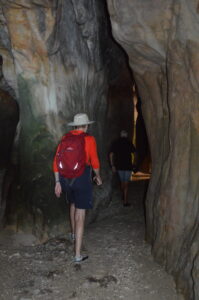
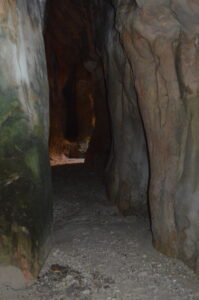
 We had an early start with a trip to visit a tunnel eroded right through a promontory of sandstone.
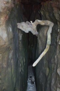 There were trees which had trapped after floating in with the tide, and then slowly worn away.
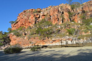
 In some ways the most striking aspect of this visit was for us to emerge from the tunnel/cave and not immediately be struck by the beautiful sandstone wall opposite.
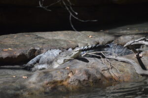
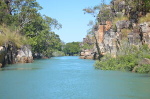 Next we had a trip up an inlet called something like: Rainforest Inlet (irony in naming?) which was very picturesque with wonderful rock “sculptures”, lovely mangroves, and a crocodile!
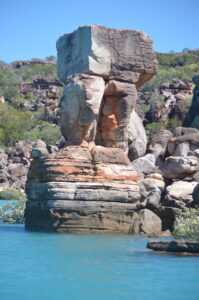 Some of the sandstone shapes are so striking because it is not obvious how they do NOT immediately collapse.
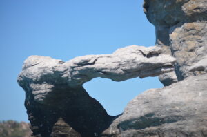 After a swim (where I received some good advice about how to improve my swimming technique from the other travellers), we visited another cave, this one not being a tunnel as there was only one real entrance.
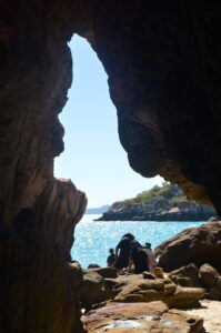
Once again I was struck by the way in which the sandstone can be eroded in ways to create extraordinary shapes, and even caves/tunnels through the rock.
The Kimberleys Day 14
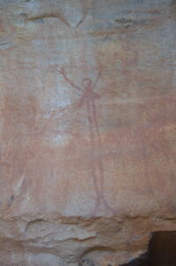
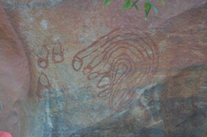
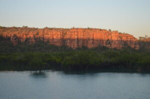 We had an early trip to shore, up an inlet off Rothsay Water, to see some very good aboriginal rock art. Apparently, there are even better examples not far from here, but the local aboriginal tribe requests very large fees for permission to view them, so no-one goes.
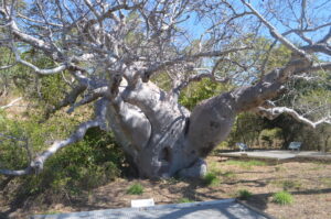
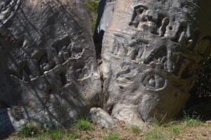 Next was a visit to Careening Island, where an early British ship stopped for some time for repairs. Part of a UNESCO-protected zone, there are many animals and birds kept safe around this area. All that we saw, though, were large Boabab trees into which sailors had carved their ships’ names and the years when they were on the island.
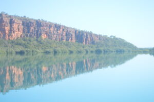
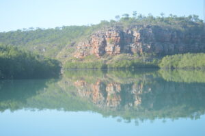 Now we are on another long leg of the voyage, towards Fredericks Bay, where we will be staying overnight. I am once again reminded that Australia has some beautiful sights and countryside, but each site or view is a long way away from the next one. Sue and I were discussing what were the most and least useful things we had brought with us. Least useful for me was a second pair of long trousers, most useful was probably the Tilley hat which I was given by Dad (broad-brimmed but with straps which make it stay on your head in all sorts of wind). However a good book runs a close second at times …. I am onto my third.
The Kimberleys Day 13
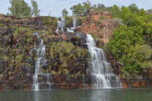
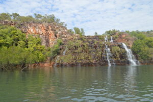
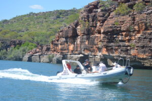 Our day started with a trip up Prince Regent River, as far as the Kings Cascade.
The Kings Cascade is a beautiful waterfall, the water coming down into the river estuary, in a small bay off the main river.
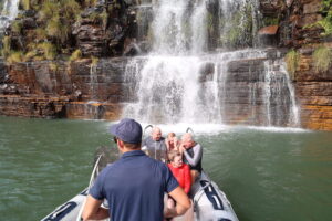
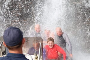
It is possible to put the nose of a boat under the waterfall itself, which is a wonderful, if somewhat cold, experience, as you might see from the sequence below:
We then aimed to get to Careening Bay, but only made it to Rothsay Water, where we spent the night.
The Kimberleys Day 12
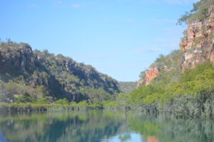 Our captain said that this was going to be a relatively slack day. However it started off with another cruise up a beautiful creek. Once again, lovely sandstone layered rock formations, mangroves and also much birdlife.
We are travelling through an area of truly beautiful and unspoiled country: since we saw the mine (Day 3 – K+2) s haven’t seen any permanent human structures at all, and only a few boats.
In Europe, especially around Britain,  we would have seen lots of buildings. Lighthouses, beacons and piers. Not so here in the Kimberleys. This traveller’s log is being compiled for the internet, but there is no internet available, and probably it will be several days before we have any sort of “coverage” again. For emergencies the boat has to carry a satellite phone, as well as all the other safety gear.
